What is a Watershed?
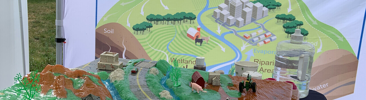
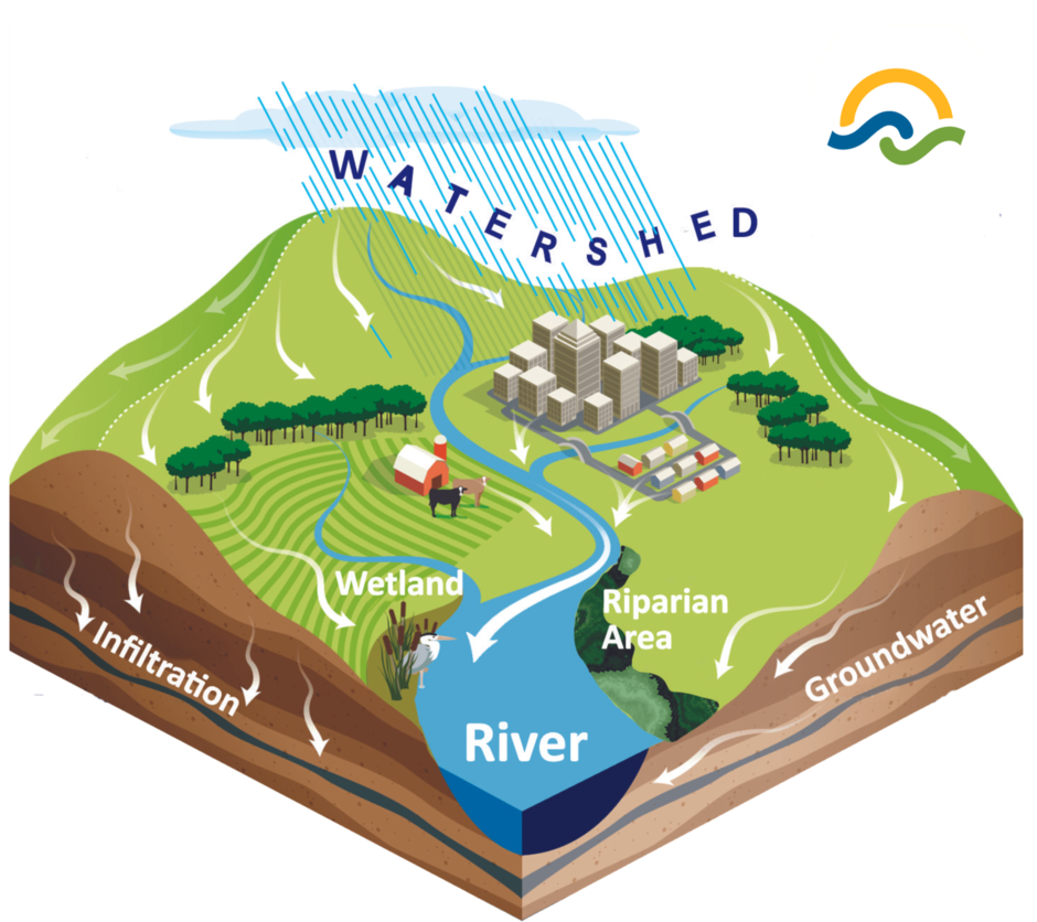
A watershed is the land area that channels rainfall and snowmelt to creeks, streams, wetlands, and rivers, and eventually the ocean. All the water in a watershed eventually drains to the same waterbody.
Natural features such as hills, rocks, soil, and plants shape - and are part of - a watershed. Human activities like roads, cities, farms, and factories can affect the natural balance within a watershed.
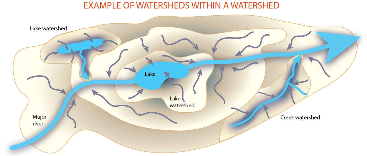
Watersheds are nested. There may be smaller watersheds nested within bigger watersheds. How does this work?
Watershed Moments Video - Watersheds Explained!
About WPACs
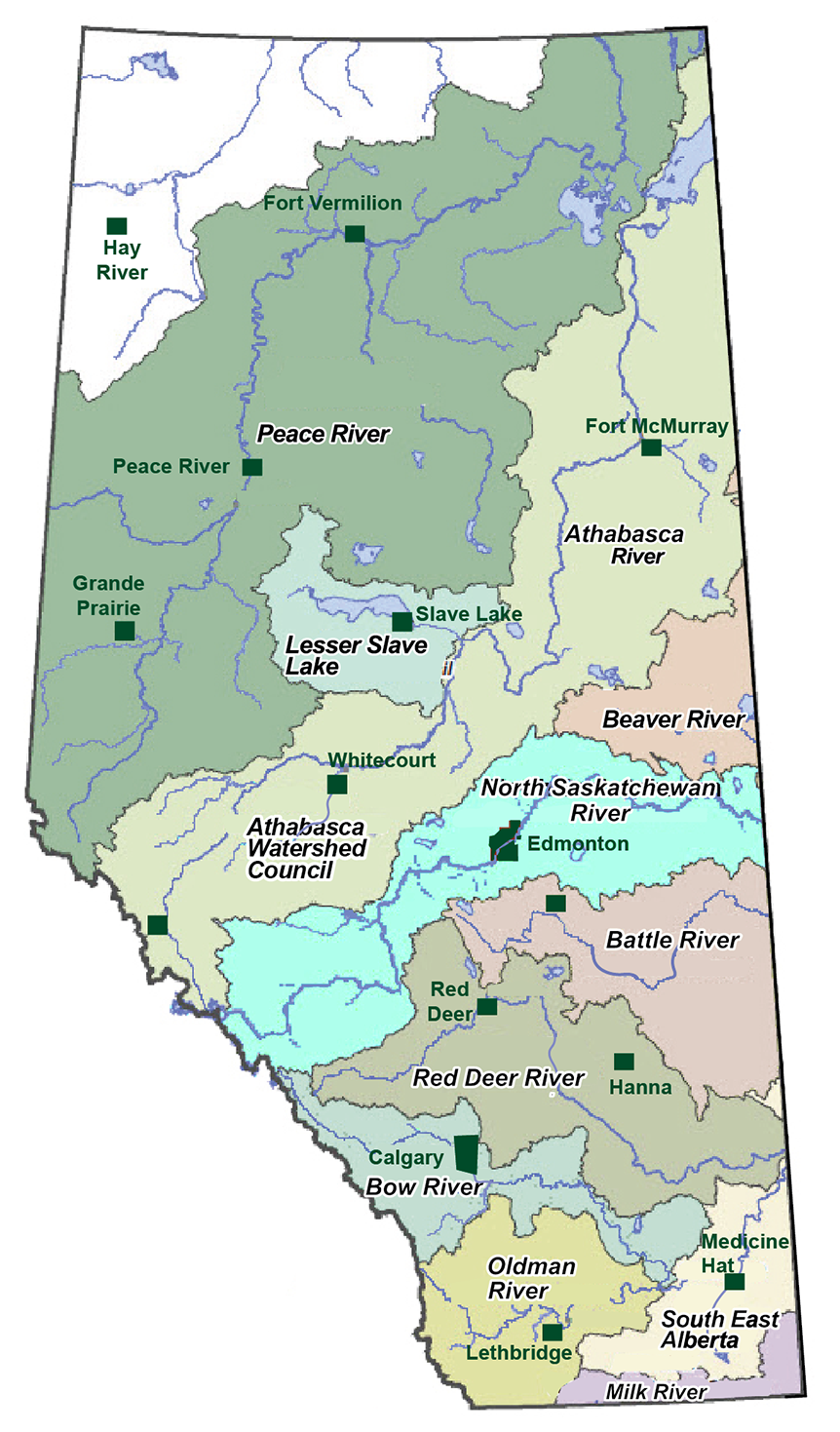
Alberta has 7 major river basins and 11 WPACs. For more information about what WPACs do or to contact another WPAC, see:
Explore the watershed through maps
What happens on the landscape shapes and impacts water quantity, water quality and water ecosystems.
The intersection between people, land and water helps us to better understand how they impact one another.
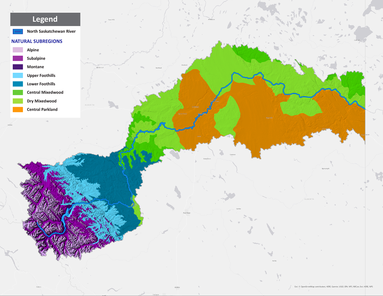
Alberta has six main ecosystems, which are known as natural regions, and are defined by their soil, geology, and vegetation. Four of these regions (and eight subregions) are found in the North Saskatchewan River watershed. These regions’ topography, climate, and vegetation determine the type and distribution of many plant, animal, and fungal species across the watershed.
- Rocky Mountain Natural Region: Includes the Alpine, Subalpine, and Montane subregions with deep gorges, mountain peaks, and upper foothills. It has the shortest summers but the highest rain and snowfall in the province. The river’s headwaters begin here.
- Foothills Regions: Sloping down from the Rockies, this region has high annual precipitation, moist mixed forests, and diverse wildlife.
- Boreal Regions - Central Mixedwood: Found in patches within the watershed, it's known for upland forests, rolling plains, and wetlands. Dry Mixedwood: This warmer boreal subregion features fens and aspen forests on rolling hills and is home to some large lakes in the west.
- Central Parkland: A heavily cultivated area between grasslands and boreal forests, known as Aspen Parkland, with many productive wetlands used by migrating waterfowl.
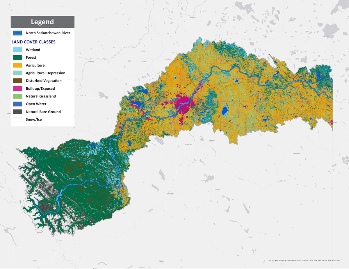
The land that makes up a watershed is both a natural and human-built environment.
Each type of land cover affects the health of a watershed in different ways:
- Forests, grasslands, and wetlands help store and filter water and help the landscape absorb water.
- Agricultural land can support wildlife and pollinators with habitat and food, but runoff from fertilizers and pesticides can get into water bodies.
- Bare ground can be either natural or human made. When vegetation is lost through by human development, bare ground is prone to erosion, which then increases sediment in water bodies.
- Urban and developed areas often have non-porous surfaces that reduce water infiltration. Green spaces and stormwater ponds can help offset these effects.
- Industrial areas need to be regulated and use sustainable methods to prevent pollutants or chemicals from entering nearby water bodies and riparian areas.
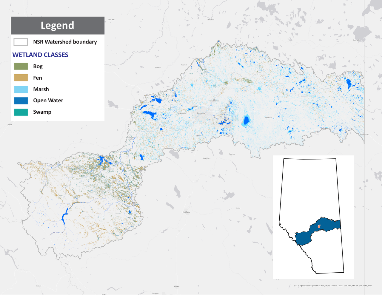
Each natural region has specific types of water bodies that are more common. For example, fens (also known as muskegs) are often found in the Rocky Mountains, while marshes are more common wetlands in the Central Parkland and Prairies.
Lentic water bodies are slow moving or still – and include ponds, lakes, marshes and wetlands. They help store water on the landscape, so they are helpful during a drought or flood. These water bodies and their surrounding riparian areas are critical spaces for bird and wildlife habitat.
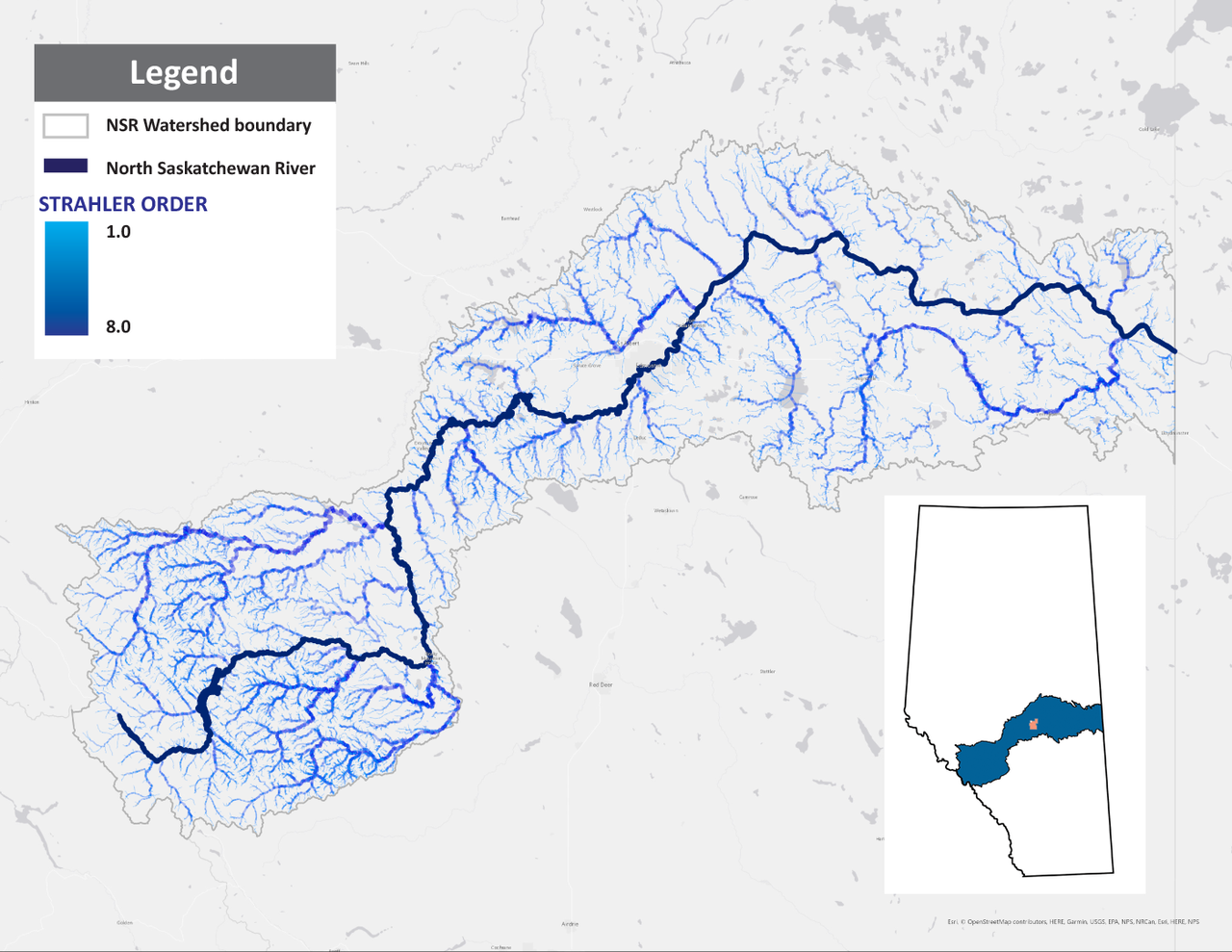
Lotic water bodies are fast moving and flowing – and include streams, creeks and rivers. Moving water is important for supplying water to communities, supporting macroinvertebrates and fish, and keeping water flowing in river mainstems.
In connection with Natural Regions, elevation plays a role in how fast water does or doesn’t move and one can observe this as a creek rushes beside a mountainside trail or moves more slowly on the flatter Prairie landscape.
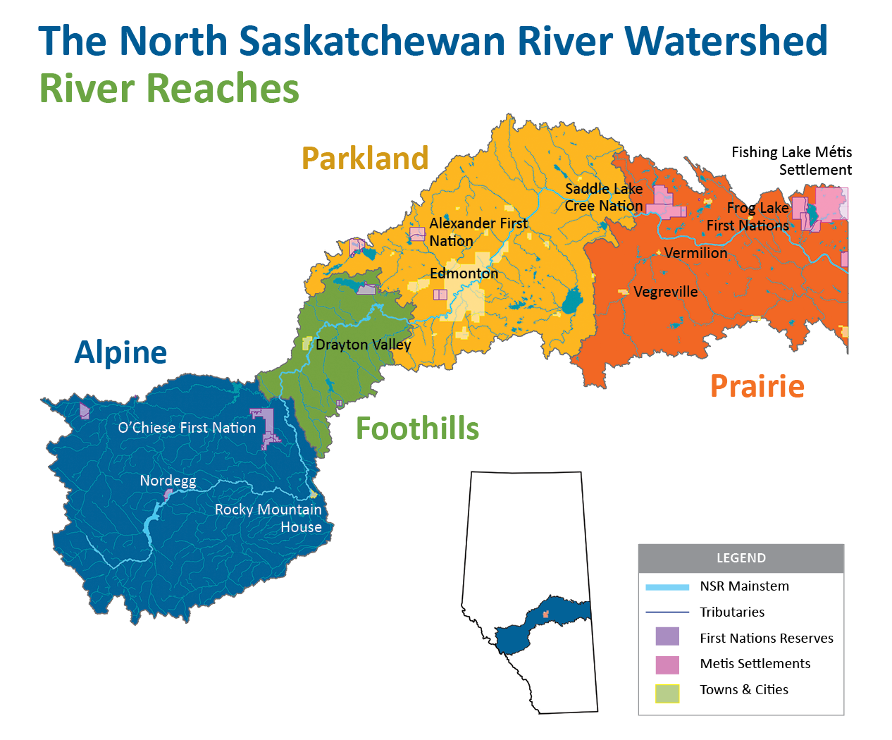
The North Saskatchewan River Watershed is currently divided into 4 river reaches, which is different than a watershed. These reaches are based on more similar natural regions and landscape and reflect our current reporting boundaries.
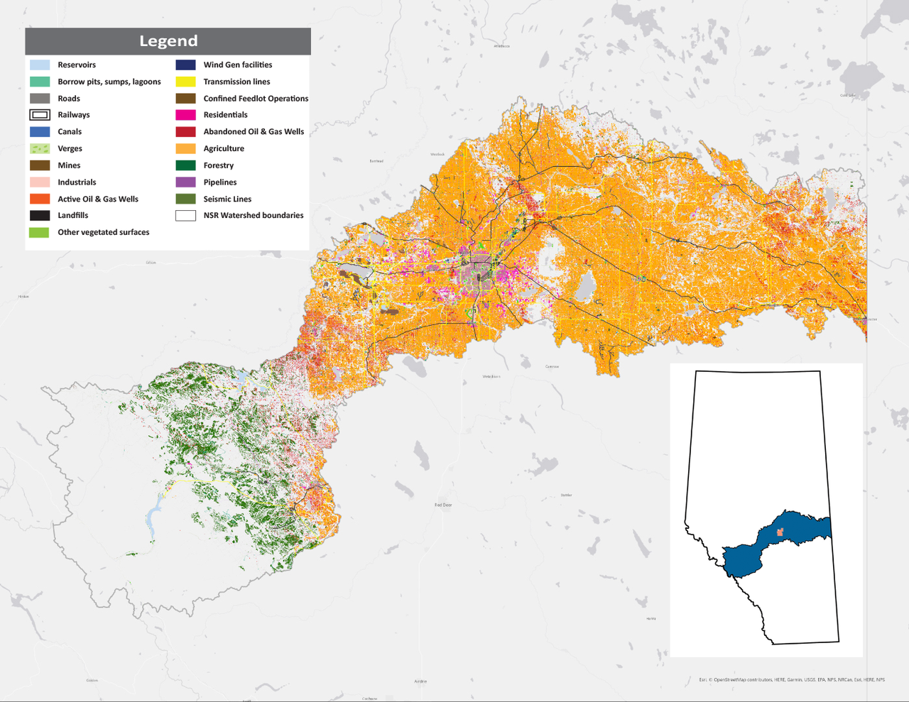
Humans shape their environment by adapting land cover for various types of land use. Land use can have big impacts on how water flows overland, what runs off into aquatic ecosystems, and impacting stream and river connectivity through roads or development.
On the other hand, parks, gardens and green areas are a positive example of how land use can maintain green belts along rivers (riparian areas) that allows species to have intact habitat, filter toxins and store water in the soil.